Hiking is an incredible way to explore the world, but some trails are not for the faint-hearted. Steep cliffs, extreme weather, and unpredictable terrain make certain hikes incredibly dangerous. In this article, we will explore the most perilous hikes on Earth and what makes them so risky.
1. Mount Huashan, China
Trail Stats:
- Distance: 8.2 miles.
- Max elevation: 6,994 ft.
- Elevation gain: 2,496 ft.
- Min elevation: 3,572 ft.
- Elevation loss: 5,600 ft.
- Trail type: One way.
Information:

Copyright: Pixabay.
Mount Huashan is famous for its infamous “Plank Walk”, where hikers must walk along wooden planks attached to the mountain’s vertical rock face. Although safety harnesses are now provided, the extreme heights and lack of guardrails make this one of the scariest hikes in the world.
Why is it dangerous?
- Extremely narrow wooden planks bolted into the cliffside
- Minimal safety measures
- Sheer drops of thousands of feet
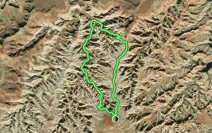
2. The Maze, Utah, USA
Trail Stats:
- Distance: 8.5 miles.
- Max elevation: 5,459 ft.
- Elevation gain: 1,230 ft.
- Min elevation: 4,527 ft.
- Trail type: Loop.
Information:

Copyright: Pixabay.
Why is it dangerous?
- Remote location with no cell service
- Unpredictable weather and flash floods
- Complex network of confusing trails
Located in Canyonlands National Park, Harvest Scene via Pete’s Mesa Route is one of the most remote and dangerous hiking destinations in the United States. Even experienced hikers can get lost due to the labyrinth-like rock formations. Without proper preparation, a wrong turn can lead to dehydration or exposure.
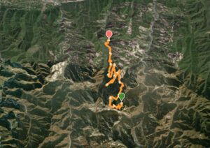
3. Drakensberg Traverse, South Africa
![]()
Trail Stats:
- Distance: 127 miles.
- Max elevation: 11,410 ft.
- Elevation gain: 22,329 ft.
- Min elevation: 5,803 ft.
- Elevation loss: 24,934 ft.
- Trail type: One way.
Information:

Copyright: Pixabay.
Why is it dangerous?
- High-altitude exposure
- Sudden weather changes
- Rigid chain ladders scaling cliffs
The Grand Drakensberg Traverse is an intense multi-day trek that requires hikers to navigate steep cliffs and unstable ladders. The high altitude can cause altitude sickness, while unpredictable weather increases the risk of hypothermia.
4. Huayna Picchu, Peru
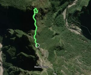
Trail Stats:
- Distance: 1.3 miles.
- Max elevation: 8,825 ft.
- Elevation gain: 708 ft.
- Min elevation: 7,985 ft.
- Elevation loss: 708 ft.
- Trail type: Loop.
Information:

Copyright: Pixabay.
Why is it dangerous?
- Steep stone steps (“Stairs of Death”)
- Slippery surfaces with no handrails
- Sudden weather shifts
Overlooking the famous Machu Picchu, Huayna Picchu is an iconic yet treacherous hike. The narrow paths and ancient stone steps become extremely slippery in the rain, and one misstep could send a hiker tumbling down steep cliffs.
5. El Caminito del Rey, Spain
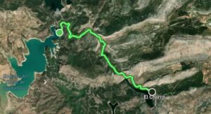
Trail Stats:
- Distance: 4.8 miles.
- Max elevation: 1,066 ft.
- Elevation gain: 2,440 ft.
- Min elevation: 459 ft.
- Elevation loss: 2,864 ft.
- Trail type: One way.
Information:

Copyright: Pixabay.
Why is it dangerous?
- Narrow walkways along sheer rock walls
- Loose or broken sections of path
- High winds can destabilize hikers
Once dubbed the “world’s most dangerous walkway,” El Caminito del Rey was originally built for workers in the 1900s. Although the trail has been renovated for safety, the experience remains thrilling, as hikers walk along narrow paths suspended hundreds of feet above the ground.
6. Aonach Eagach Ridge, Scotland
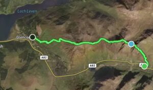
Trail Stats:
- Distance: 7.2 miles.
- Max elevation: 3,159 ft.
- Elevation gain: 3,697 ft.
- Min elevation: 55 ft.
- Elevation loss: 3,697 ft.
- Trail type: Loop.
Information:

Copyright: Unsplash.
Why is it dangerous?
- Knife-edge ridges with sheer drops
- Unpredictable weather conditions
- No easy escape routes
The Aonach Eagach Ridge is a stunning yet perilous hike in the Scottish Highlands. The route is extremely narrow, with sheer drops on either side. Fog and rain can make navigation even more difficult, increasing the risk of fatal falls.
7. Kalalau Trail, Hawaii, USA
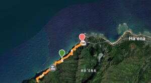
Trail Stats:
- Distance: 5.2 miles.
- Max elevation: 790 ft.
- Elevation gain: 1,253 ft.
- Min elevation: 9 ft.
- Elevation loss: 1,624 ft.
- Trail type: Loop.
Information:

Copyright: Pixabay.
Why is it dangerous?
- Unstable cliffs along the coastline
- Flash floods and rising tides
- Remote location with no road access
Stretching along the Nā Pali Coast, the Kalalau Trail is breathtaking but hazardous. Parts of the trail run along crumbling cliffs where hikers must carefully navigate narrow, slippery paths with the Pacific Ocean crashing below.
8. The Snowman Trek, Bhutan
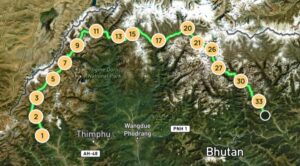
Trail Stats:
- Distance: 166.9 miles.
- Max elevation: 17,160 ft.
- Elevation gain: 57,572 ft.
- Min elevation: 9,350 ft.
- Trail type: One way.
Information:

Copyright: Pxabay.
Why is it dangerous?
- High altitudes above 5,000 meters (16,400 feet)
- Harsh, unpredictable weather
- Risk of avalanches and landslides
The Snowman Trek is one of the hardest hikes in the world, spanning across the rugged mountains of Bhutan. Due to its high elevation, hikers must deal with extreme cold, altitude sickness, and the possibility of deadly avalanches.
9. Mount Washington, USA
Trail Stats:
- Distance: 4.5 miles.
- Max elevation: 6,289 ft.
- Elevation gain: 4,488 ft.
- Min elevation: 2,066 ft.
- Elevation loss: 249 ft.
- Trail type: One way.
Information:

Copyright: Pixabay.
Why is it dangerous?
- Fast-changing and extreme weather conditions
- Strong winds exceeding 200 mph (322 km/h)
- Risk of hypothermia and frostbite
Despite its relatively low elevation, Mount Washington in New Hampshire holds the record for some of the strongest winds on Earth. Sudden temperature drops and unexpected storms have led to multiple hiker fatalities over the years on this trail.
10. Angel’s Landing, Utah, USA
Trail Stats:
- Distance: 4.9 miles.
- Max elevation: 5,718 ft.
- Elevation gain: 1,456 ft.
- Min elevation: 4,301 ft.
- Elevation loss: 1,456 ft.
- Trail type: Loop.
Information:

Copyright: Pixabay.
Why is it dangerous?
- Extremely narrow ridge with steep drop-offs
- High winds and unstable footing
- No room for error
One of the most popular hikes in Zion National Park, Angel’s Landing is also one of the most dangerous. The final section of the hike features a razor-thin ridge with chains for support, but strong gusts of wind and crowds of hikers make every step a challenge.
Final Thoughts
These hikes are breathtaking but come with serious risks. If you decide to take on any of these dangerous hikes, always ensure you:
- Check the weather conditions in advance
- Bring proper gear and supplies
- Travel with an experienced guide when necessary
- Stay alert and respect safety precautions
Start planning your next hiking trip today! Click here for a guide on how to do it.