
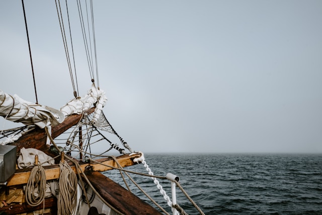
Sailing is an adventure, but some routes pose extreme challenges even for the most experienced sailors. Harsh weather, unpredictable currents, and hazardous obstacles make certain areas among the most dangerous waters to navigate. If you’re planning an ambitious voyage, it’s essential to be aware of these perilous routes.
1. The Drake Passage (Between South America and Antarctica)
The Drake Passage is one of the most feared and respected maritime corridors in the world. Located between the southern tip of South America—nestled between Cape Horn (Chile) and the Antarctic Peninsula—this 800-kilometer-wide waterway is a place where the forces of nature reign supreme. It is here that the Atlantic, Pacific, and Southern Oceans meet in a chaotic confluence, unleashing some of the most extreme sea conditions known to sailors.
What makes the Drake Passage so notorious isn’t just its remote location, but the relentless natural forces that dominate it. With no significant landmass to block wind or currents between Antarctica and the southern latitudes of other continents, the area becomes a vast wind tunnel, capable of generating massive storms and ferocious waves in a matter of hours.
What Sailors Face in the Drake Passage
Those brave enough to cross these waters—whether on research vessels, expedition cruises, or sailing yachts—must contend with:
-
Winds regularly exceeding 50 knots (92+ km/h), with sudden gusts capable of damaging even the most reinforced sails and rigging.
-
Towering waves reaching up to 40 feet (12 meters), often breaking and crashing over decks in rapid succession, leaving no time for recovery.
-
Rogue waves—unexpectedly large and steep waves—are known to appear here, defying conventional sea behavior.
-
Free-floating icebergs and growlers (small, hard-to-spot chunks of glacial ice) that drift unpredictably, posing catastrophic collision risks, especially in low visibility conditions.
-
Bone-chilling temperatures, coupled with freezing spray and icy decks, which further complicate navigation and safety measures.
Survival Demands More Than Skill
Successfully crossing the Drake Passage is a feat of seamanship. It requires not only a sturdy, ice-rated vessel and state-of-the-art navigation equipment, but also a deeply experienced crew trained in polar survival, weather prediction, and crisis management. Even then, the Drake has humbled some of the most seasoned sailors and claimed countless ships throughout history.
Despite advances in modern technology, the passage remains a true test of human resilience. It’s often said among mariners that “you don’t conquer the Drake Passage—you endure it.”
Why It Matters
Understanding the Drake Passage is crucial not just for adventurers but also for scientists and environmentalists. As the primary gateway to Antarctica, this route is vital for climate research, conservation efforts, and global oceanic circulation studies. It plays a key role in regulating Earth’s temperature, making it one of the most environmentally significant regions in the world.

Photo by Michele2214 on Pixabay.
2. The Bermuda Triangle (Western Atlantic Ocean)
The Bermuda Triangle—also known as the Devil’s Triangle—is a loosely defined region in the western part of the North Atlantic Ocean, with its three corners forming a triangle between Miami (Florida), Bermuda, and San Juan (Puerto Rico). For decades, this enigmatic zone has captivated the public imagination, becoming the epicenter of stories involving vanished aircraft, lost ships, and inexplicable phenomena.
With over 1,000 recorded disappearances, the Bermuda Triangle has built a reputation that blurs the line between legend and reality. While many theories—ranging from alien abductions to interdimensional portals—have been proposed to explain the mysteries of this area, scientific evidence points toward very real, natural maritime dangers that make this region challenging for sailors and pilots alike.
Real Dangers Lurking in the Bermuda Triangle
Despite the dramatic folklore, experienced navigators know that the perils of the Bermuda Triangle are largely due to environmental and navigational hazards that demand respect and caution:
-
Rapidly Changing Weather
The area is known for sudden, violent storms that can develop within minutes, fueled by warm ocean waters and shifting atmospheric conditions. Tropical depressions and hurricanes are common, especially between June and November. These storms can bring zero visibility, towering waves, and dangerous wind gusts capable of crippling even modern vessels. -
The Gulf Stream’s Powerful Currents
One of the most significant ocean currents in the world—the Gulf Stream—flows right through the Bermuda Triangle. This powerful, fast-moving body of water can easily carry a small vessel miles off course, break apart wreckage, or even mask the location of sunken ships and debris, complicating rescue and recovery operations. -
Magnetic Anomalies and Navigation Disruptions
Some pilots and sailors have reported compass malfunctions and strange deviations while passing through the triangle. While the Earth’s magnetic field varies globally, the Bermuda Triangle is one of the few places where true north and magnetic north align—a phenomenon that can confuse traditional compass-based navigation when not accounted for properly. -
Shallow Waters and Submerged Reefs
Parts of the triangle contain shallow areas and complex underwater topography, including the extensive coral reef systems around the Bahamas, which can pose grounding risks. Navigating through these areas, especially in poor visibility or during night passages, requires precision and vigilance.
Historical Incidents That Shaped the Legend
Many high-profile disappearances have fed the Bermuda Triangle mythos. Some of the most notable include:
-
Flight 19 (1945): A squadron of five U.S. Navy bombers vanished during a routine training mission. A rescue plane sent to find them also disappeared.
-
USS Cyclops (1918): A 542-foot-long Navy cargo ship with 309 men aboard disappeared without a trace—no wreckage or distress call ever found.
-
The Witchcraft (1967): A cabin cruiser vanished less than a mile from Miami after a distress call was made; the Coast Guard never found the vessel or its occupants.
These events, though often explained by human error, mechanical failure, or environmental factors, continue to fuel speculation and intrigue.
Navigating the Triangle: Preparedness Is Key
Despite its ominous reputation, thousands of ships and aircraft cross the Bermuda Triangle every year without incident. For modern mariners and aviators, the key to a safe journey lies in preparation, situational awareness, and technological support:
-
Regularly monitor weather conditions and avoid sailing during storm seasons.
-
Use redundant navigation systems, including GPS, radar, and AIS, in addition to traditional charts and compasses.
-
Ensure emergency protocols, life-saving equipment, and communication tools are up to date and functional.
-
File float plans and maintain regular contact with coast stations or maritime authorities.
Separating Fact from Fiction
While it’s easy to get swept up in the Bermuda Triangle’s mystique, it’s important to distinguish between scientifically explainable risks and sensationalized myths. What makes this region fascinating isn’t just the legends—it’s the convergence of complex oceanographic and atmospheric systems that create a natural challenge for seafarers and aviators alike.
Understanding these hazards transforms the Bermuda Triangle from a place of fear into one of respect—where knowledge, skill, and caution are the keys to safe passage.

Bermuda – Photo by LawJr on Pixabay.
3. The Cape of Good Hope (South Africa)
Nicknamed the “Cape of Storms” by Portuguese explorer Bartolomeu Dias in 1488, the Cape of Good Hope has earned a legendary reputation among mariners for its treacherous conditions and unpredictable seas. Located at the southern tip of the African continent, this formidable headland marks the meeting point of the Atlantic and Indian Oceans, creating a volatile and often dangerous maritime environment.
For centuries, the Cape has served as a critical waypoint for global trade, exploration, and adventure. Yet despite advances in maritime technology, it remains one of the most feared and respected sea routes in the world.
A Perfect Storm: Why the Cape Is So Dangerous
Sailing around the Cape of Good Hope is not for the faint of heart. The geographical and climatic factors that converge here make it one of the most extreme ocean passages on Earth:
-
Ferocious Winds Often Exceeding 60 Knots
The Cape is regularly hammered by south-easterly trade winds and strong westerlies, especially during the Southern Hemisphere’s winter months (June to August). These winds are notorious for their sudden shifts and violent gusts, often exceeding 60 knots (110+ km/h), creating hazardous conditions for sailing and navigation. -
Sudden, Towering Swells
Massive swells, sometimes reaching 8 to 10 meters (26–33 feet), can arise with little warning, especially during low-pressure systems that sweep across the Southern Ocean. These swells are known for their long wavelength and forceful impact, often slamming into vessels with incredible power and catching crews off guard. -
Clashing Ocean Currents
The Agulhas Current, flowing south along the east coast of Africa, meets the colder Benguela Current from the west at the Cape. When these two opposing forces collide, they create intense turbulence, whirlpools, and rogue waves, some of which have been recorded as towering over 20 meters (65 feet). This collision zone is one of the few places on Earth where ships have reported freak waves capable of capsizing even modern freighters and tankers. -
Frequent Fog and Low Visibility
Moist air from the Indian Ocean often condenses over the colder waters of the Atlantic, producing thick fog banks that can drastically reduce visibility. Combined with strong winds and unpredictable seas, these conditions make navigation even more perilous.
Historical Significance and Shipwrecks
The Cape of Good Hope has played a pivotal role in maritime history. During the Age of Exploration, it was seen as a gateway to the riches of the East—yet also a graveyard for ships. The area surrounding the Cape is dotted with the remains of hundreds of shipwrecks, many of which succumbed to the ferocious conditions before modern navigation tools existed.
One of the most famous tales is that of the Flying Dutchman, a legendary ghost ship doomed to sail the Cape’s waters forever. Whether myth or metaphor, the story speaks to the fear and respect this region has long inspired among sailors.
Modern Navigation: Still a Test of Skill
Despite GPS, satellite weather forecasts, and advanced hull engineering, even experienced captains must prepare meticulously to navigate the Cape safely:
-
Route Planning: Timing is critical. Mariners often wait for a “weather window” before attempting the passage, sometimes delaying for days or weeks.
-
Storm Readiness: Vessels need to be structurally reinforced for heavy seas, with redundant steering, emergency equipment, and watertight integrity.
-
Crew Training: Every crew member must be well-versed in storm protocols, man-overboard procedures, and emergency navigation.
-
Local Knowledge: Hiring a local pilot or consulting regional weather advisories can significantly reduce risk.
Environmental and Oceanographic Importance
The Cape is not just a challenge for sailors; it’s also ecologically and oceanographically significant. The convergence of two major oceans supports extraordinary biodiversity, making the surrounding waters a hotspot for marine life—from southern right whales and great white sharks to penguins and seals.
It’s also a critical point for studying global ocean circulation, particularly the Agulhas Leakage, a phenomenon where warm Indian Ocean waters “leak” into the Atlantic, affecting global climate systems.

South Africa, Cape of Good Hope – Photo by Sharonang on Pixabay.
4. The Gulf of Aden (Between Yemen and Somalia)
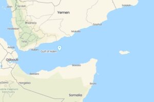
The Gulf of Aden, a critical maritime chokepoint located between the Arabian Peninsula (Yemen) and the Horn of Africa (Somalia), has long been a strategic gateway connecting the Red Sea to the Arabian Sea—and by extension, the Mediterranean Sea to the Indian Ocean via the Suez Canal. This narrow stretch of water is one of the busiest shipping lanes in the world, facilitating the transit of roughly 10% of global trade, including vital oil and cargo shipments.
Yet for all its strategic and economic importance, the Gulf of Aden is among the most dangerous maritime regions on the planet, not because of its natural conditions alone, but due to a persistent and lethal threat: modern piracy.
Piracy: The Real and Present Danger
While piracy may sound like a relic of the past, in the Gulf of Aden, it remains a current and evolving threat, particularly for commercial vessels, private yachts, and humanitarian ships. Despite ongoing international naval efforts to patrol and secure the area, piracy continues to pose a substantial risk. Some of the dangers include:
-
Frequent Pirate Attacks
Armed Somali pirates often operate in small, fast-moving skiffs launched from larger mother ships, targeting vessels that are poorly guarded or traveling alone. Attacks involve boarding with ladders and grappling hooks, taking hostages, and demanding millions in ransom. While the peak of piracy occurred between 2008 and 2012, sporadic but dangerous attacks still occur, particularly against smaller or slower-moving vessels. -
Heavily Armed Gangs
Pirates in the region are often well-armed with AK-47s, rocket-propelled grenades (RPGs), and even satellite phones, operating with increasing tactical sophistication. Some groups are supported by organized criminal syndicates, with connections to insurgent or terrorist networks. -
Kidnapping and Hostage Scenarios
Unlike in some regions where piracy is focused on stealing cargo, pirates in the Gulf of Aden frequently seek hostage ransom, sometimes detaining crews for months or even years. The psychological and physical toll on those captured can be devastating.
Natural Challenges Compound the Risk
In addition to piracy, mariners must contend with unforgiving natural conditions that amplify the risk factor of this already volatile region:
-
Unpredictable Weather Systems
The Gulf of Aden experiences strong seasonal winds during the monsoon months (typically June to September), which can stir up high seas, reduce visibility, and make small boats particularly vulnerable. Storm surges and sudden squalls can appear with little warning, further complicating navigation and defense. -
Extreme Heat and Limited Shelter
Temperatures in the region can soar above 45°C (113°F), placing extreme strain on crew and equipment. Compounding the issue is the lack of safe harbors or friendly ports where vessels can seek refuge in case of mechanical failure, weather emergencies, or pirate encounters. -
Geopolitical Instability
The surrounding regions, including Yemen and parts of Somalia, are plagued by civil conflict, terrorism, and political unrest. This volatility limits the ability of governments to enforce maritime law, leaving much of the open water in a state of quasi-anarchy.
A Necessary but Perilous Passage
For many ships, the Gulf of Aden is not avoidable—it is an essential route between Europe and Asia, particularly for vessels transiting through the Suez Canal. However, the decision to transit this region must be weighed carefully, balancing commercial priorities with human safety and security considerations.
Sailors who choose to navigate these waters do so knowing that the risks are real—and that vigilance, preparation, and respect for the danger are their best defenses.

Yemen and Somalia, Gulf of Aden – Photo by Francois Falanga on Pixabay.
5. The North Atlantic (Between the U.S. and Europe)
The North Atlantic Ocean has long held a fearsome reputation among sailors, navigators, and historians. Spanning from the eastern coast of North America to the western shores of Europe, this oceanic expanse has witnessed centuries of maritime exploration, trade, and tragedy. While it serves as one of the most trafficked shipping routes in the world, it is also one of the most dangerous bodies of water for long-distance sailing, especially during storm seasons.
From legendary shipwrecks like the Titanic to the relentless fury of Atlantic hurricanes, the North Atlantic demands respect, preparation, and experience. Even in the modern era of advanced forecasting and satellite communication, it remains a place where natural forces can overpower human technology.
Extreme Weather: The Biggest Threat to North Atlantic Mariners
The weather in the North Atlantic is notoriously volatile, shaped by a complex interaction of oceanic and atmospheric systems. Key dangers include:
-
Hurricane Season (June–November)
The North Atlantic is home to one of the most active tropical cyclone basins in the world. Hurricanes originating in the warm waters of the Caribbean and West Africa often track northward, intensifying as they move across open water. These storms can bring:-
Sustained winds over 100 knots (185+ km/h)
-
Seas exceeding 15 meters (50 feet)
-
Torrential rain and zero visibility
Notable hurricanes such as Hurricane Sandy (2012) and the Great Hurricane of 1780 have devastated ships, coastlines, and entire cities.
-
-
Winter Storms and Nor’easters
During the colder months, the North Atlantic is hammered by powerful low-pressure systems, often forming “bomb cyclones” with hurricane-force winds and heavy snow or sleet. These storms develop rapidly and are difficult to predict, often resulting in treacherous sailing conditions for days at a time.
Icebergs and Arctic Waters: A Cold, Hidden Threat
-
Icy Waters and Icebergs near Greenland and Newfoundland
In the northern reaches of the Atlantic, particularly near the Labrador Current and the coast of Greenland, icebergs become a significant hazard. These floating giants can extend deep below the surface, and smaller “growlers” or “bergy bits” are often nearly invisible to radar.The infamous Titanic disaster of 1912 occurred in this region, when the ocean liner struck an iceberg and sank, killing over 1,500 passengers and crew. That tragedy led to the formation of the International Ice Patrol, which still monitors and reports on iceberg movement in the region today.
-
Supercooled Water and Hypothermia Risk
Water temperatures in the North Atlantic often remain near freezing. In an emergency, even with a life jacket, survival time in these frigid waters is often measured in minutes, not hours, due to rapid-onset hypothermia.
Powerful Currents and Navigational Complexity
-
The Gulf Stream and Labrador Current
Two major currents shape the dynamic environment of the North Atlantic:-
The Gulf Stream, a warm and fast-moving current that flows from the Gulf of Mexico along the U.S. East Coast and toward Europe.
-
The Labrador Current, a cold current flowing south from the Arctic along the Canadian coast.
When these opposing currents meet, they create steep, confused seas, sudden temperature shifts, and intense fog. These waters can also produce rogue waves—unexpected, massive waves that can appear without warning and overwhelm even large vessels.
-
-
Magnetic Interference and Equipment Failures
Northern latitudes are known for causing magnetic compass deviation, which can confuse navigation systems. In high seas or during electrical storms, communication and positioning systems may also become unreliable.
Historical Significance and Notorious Shipwrecks
The North Atlantic has claimed thousands of vessels over the centuries. In addition to the Titanic, other tragedies include:
-
The SS Andrea Doria (1956): A luxury liner that collided with another ship in heavy fog and sank off the coast of Massachusetts.
-
The Edmund Fitzgerald (1975): While technically on Lake Superior, this Great Lakes freighter has often been linked to the same storm systems that brew in the North Atlantic.
-
Countless U-boat attacks during both World Wars, especially in the shipping lanes between the U.S. and Europe, making the North Atlantic a historic battlefield as well.
Safe Sailing in the North Atlantic: What It Takes
Despite the dangers, thousands of vessels—including cargo ships, transatlantic yachts, and passenger liners—safely cross the North Atlantic every year. The difference lies in preparation and respect for the environment:
-
Advanced Route Planning
Using modern weather routing software, sailors can avoid high-risk storm paths and find more favorable currents to reduce time at sea. -
Ice Monitoring
Checking updates from the International Ice Patrol and using thermal imaging or radar to identify icebergs in fog-prone zones. -
Sturdy, Ocean-Ready Vessels
Boats must be well-built, with watertight integrity, storm sails, reinforced rigging, and adequate fuel reserves for engine use when sailing becomes too risky. -
Experienced Crews and Redundancy
Competent crew members, thorough emergency drills, and backup systems for navigation, power, and communication are essential.

Photo by Jbauer-fotographie on Pixabay.
6. The Southern Ocean (Around Antarctica)
The Southern Ocean, encircling the frozen continent of Antarctica, is widely considered the most hostile ocean on Earth. Unlike other oceans, it is not bound by continental landmasses, allowing wind and wave systems to circulate unimpeded around the globe. This unique geography, combined with extreme weather and frigid temperatures, makes it one of the most dangerous regions for any mariner to traverse.
Stretching from roughly 60° South latitude to the Antarctic coastline, the Southern Ocean is not just a cold and remote body of water—it is a battleground of nature, where some of the planet’s most violent oceanic and atmospheric forces converge.
Roaring Forties, Furious Fifties, and Screaming Sixties
One of the most defining and feared characteristics of the Southern Ocean is its unrelenting wind patterns. These powerful wind belts are known by legendary names for a reason:
-
Roaring Forties (40°–50° S): Constant westerly winds, often exceeding 30–40 knots, race around the globe with virtually no landmass to slow them.
-
Furious Fifties (50°–60° S): Winds intensify even further, often exceeding 50 knots, creating massive swells and dangerous gusts.
-
Screaming Sixties (south of 60° S): The most extreme zone, where storms form quickly and unpredictably, producing hurricane-strength winds and near-zero visibility.
These wind zones drive continuous storm systems and gigantic waves, making navigation here particularly brutal—even for the most experienced sailors and well-built vessels.
Massive, Relentless Waves and Swell Patterns
The wave action in the Southern Ocean is unlike any other region in the world. Because there’s no landmass to break the energy of the wind, waves can travel thousands of kilometers, building into massive, rolling swells that can reach heights of 15 meters (50 feet) or more.
-
Rogue waves—rare but devastating—have been recorded at over 25 meters (82 feet).
-
Swells are long-period and powerful, making it extremely difficult for vessels to surf or outrun them.
-
The “wave train” effect means storms don’t come and go—they build and layer, making the sea state persistently severe.
Even steel-hulled expedition yachts and commercial icebreakers often report violent rolling, broaching, and instances of hull stress in these seas.
Freezing Temperatures and the Ice Menace
Beyond the winds and waves, sailors must contend with bone-chilling temperatures. Even during the Antarctic summer (November to March), sea surface temperatures hover just above freezing. These conditions bring several critical risks:
-
Hypothermia: Exposure to cold winds and icy water can induce life-threatening hypothermia within minutes. Even well-insulated gear is tested to its limits here.
-
Icing on Deck and Rigging: Supercooled sea spray freezes instantly upon contact with exposed surfaces, adding dangerous weight to masts and sails, and increasing the risk of capsize or structural failure.
-
Sea Ice and Icebergs: Particularly in late winter and early spring, sailors must navigate through floating ice fields, bergy bits, and growlers that can shred hulls or damage rudders. Icebergs—some the size of cities—can drift thousands of kilometers from the continent.
A Sailor’s Everest: Navigating the Southern Ocean
Sailing the Southern Ocean is often compared to climbing Mount Everest, not only because of its physical demands but also due to the sheer level of preparation and risk involved. Those who enter this realm usually fall into three categories:
-
Expedition Vessels – Research or documentary crews exploring Antarctic waters, often with hardened steel hulls, satellite navigation, and onboard meteorologists.
-
High-Latitude Cruisers – Highly experienced private sailors, often solo or short-handed, attempting circumnavigations or polar routes.
-
Professional Ocean Racers – Events like the Vendée Globe or the Ocean Race send elite sailors into these waters with custom-built boats capable of surviving the extreme.
For these sailors, preparation involves:
-
Weather routing with real-time satellite data
-
Double or triple redundancies for navigation, power, and heating systems
-
Specialized cold-weather gear, including survival suits and dry shelters
-
Constant risk management, as rescue is nearly impossible in many areas
A Place Few Dare to Enter
Despite being the youngest and least explored ocean, the Southern Ocean plays a crucial role in Earth’s climate regulation, carbon cycling, and global ocean circulation through the Antarctic Circumpolar Current. Yet, for mariners, it remains a merciless gauntlet.
Unlike the more navigated Atlantic or Pacific routes, here:
-
There are no friendly ports or rescue stations for thousands of miles
-
Distress signals may go unanswered for days or weeks
-
Self-sufficiency is not optional—it’s mandatory

Photo by Torsten Dederichs on Unsplash.
Conclusion
These dangerous sailing routes are not for the faint-hearted. Proper preparation, a strong vessel, and advanced navigation skills are essential for those daring enough to take on these challenges. Whether facing fierce storms, rough seas, or piracy threats, being aware of the risks can make the difference between an exciting adventure and a perilous journey.


